Absolute location is the precise point where a place is located on Earth. Your street address is one way of giving the absolute location of your home. Every feature is located at a precise, or absolute, point on Earth.

The Global Grid
Major Lines and Using Latitude/Longitude
Absolute location
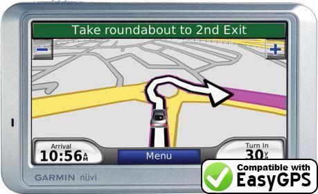
GPS is a tool we use to determine absolute location. It helps us navigate our precise points on the Earth (as long as our technology is working!)
Did you know?
The US Navy developed the first GPS to track submarines!
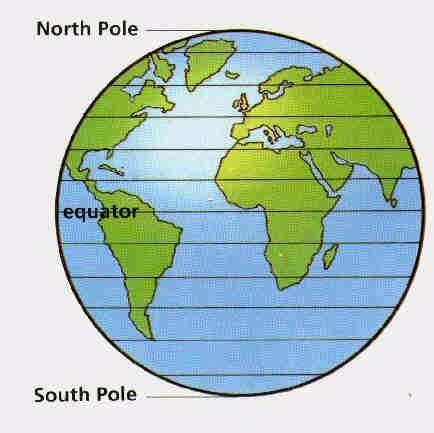
Lines of latitude are also called parallels. Latitude lines are the same distance apart. The equator is the most important line of latidude. It divides the Earth into the Northern and Southern hemispheres because it circles the Earth exactly between the North and South poles. All lines of latitude are measured from the equator in degrees.
Quiz
What line is the starting point for measuring latitude?
- Tropic of Cancer
- Tropic of Capricorn
- Equator
- Prime Meridian
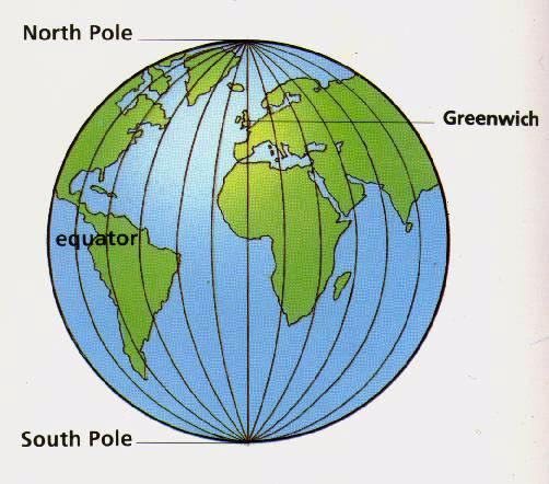
Lines of longitude are also called meridians. The starting point for measuring longitude is the Prime Meridian. It is 0 degrees longitude. These lines run from the North Pole to the South; these lines are NOT parallel! The Prime Meridian divides the Earth into the Eastern and Western hemispheres. It is also the starting point for measuring longitude.
Quiz
What two hemispheres are formed by the Prime Meridian?
- Northern and Southern hemispheres
- Eastern and Western hemispheres
- Northern and Western hemispheres
- Southern and Eastern hemispheres
Did you know?
The North and South poles are lines of latitude. They are 90 degrees north and south latitude respectively.
Plotting Latitude and Longitude coordinates
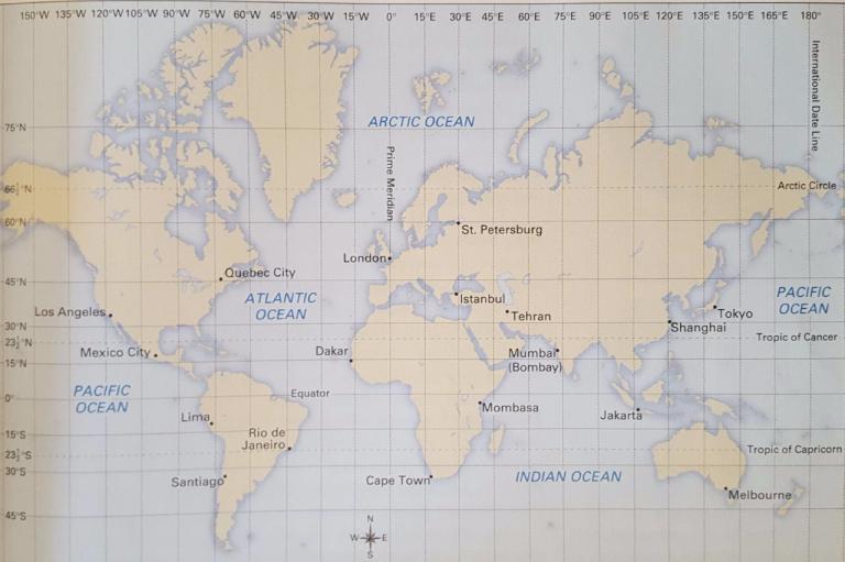
Use this image to answer the following practice questions using coordinates.
Quiz
What is the city located at 47 °N, 71°W?
- Los Angeles
- Mexico City
- London
- Quebec City
Quiz
What is the city located at 38 °S, 145°E?
- Melbourne
- Cape Town
- Istanbul
- Tokyo
Quiz
What is the city located at 41 °N, 29°E?
- Tehran
- Shanghai
- Istanbul
- Los Angeles
Quiz
What is the city located at 19 °N, 73°E?
- Mombasa
- Jakarta
- Dakar
- Mumbai
Quiz
What are the approximate coordinates for Santiago?
- 45°N, 70°W
- 33°S, 70°W
- 33°S, 70°E
- 45°S, 70°W
Quiz
What are the approximate coordinates for Tokyo?
- 35°S, 140°W
- 40°N, 140°E
- 35°E, 135°E
- 35°N, 140°E
Relative Location
Maps also show the relative location of places on Earth. This is the location of one place compare to another. Most of the time we tell people where places are by giving directions-we say where something is in relation to another place.
Relative versus Absolute location